SOFTWARE - [Photo GPS Extract]
I am currently working on a new version of Photo GPS Extract. This version will offer a lot of cool new features. Many of them are based on user requests I got during the past year.
Because of all the new features this version is still in Beta-phase, but you can already download a free copy of this version.
First of all PGE was written in a newer version of the .NET framework (4.0), as this resolved some bugs. I realize there are even more modern versions of the .NET framework (4.5), but these aren't compatible with Windows XP.
Photo GPS Extract has a new internal software architecture. The software can now show multiple locations on a Google Map. You can easily change between opened locations by clicking a button in PGE's status bar.
You can also select a picture by clicking a marker on the map. This will cause PGE to activate the selected photo.
The previous version of PGE was just a simple web browser application. Each time a new photo was opened, the GPS coordinates were extracted and then transferred (as URL-parameters) to the web page http://tools.bvsystems.be/pge4.php.
PGE5 works differently: the Google Map is loaded only once. Then PGE starts communicating with the Google Map by executing JavaScript functions. This allows the map to function much smoother: new locations are added instantly without the need to reload the complete map. This also increased privacy: your requested GPS coordinates are no longer transferred through my web page (tools.bvsystems.be).

PGE can now keep a list with the recently used files. This allows quicker access to old search results.
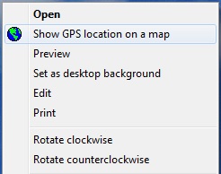
PGE can now be integrated into the Windows Explorer's right-click menu. This allows quicker access to the program.
PGE can now show much more EXIF information. A button in the status bar allows you to see all relevant GPS fields.
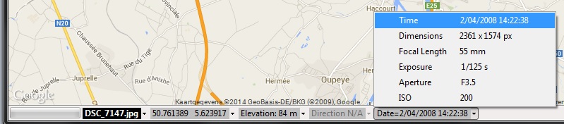
This new EXIF information can also exported with the Batch Extractor. The following data fields are now available:

The Batch Extractor has been improved a lot. It had some bugs with caused the extracting process to stop when one of the JPG had a problem. Now the problem JPG is now just skipped.
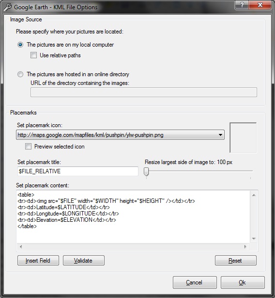
PGE 4.0 already allowed you to export to Google Earth/KML files but the new version 5 offers much more flexibility. You can select: the location of the pictures, the pushpin icon, the pushpin title, the pushpin text. You can even show variables in your texts, so you can customize the files completely.
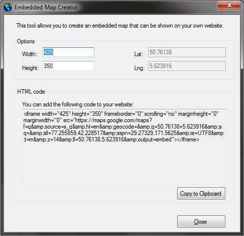
You now can generate an embedded Google Map from the location that is currently selected on the map.
The new version of PGE can instantly show the GPX track that belongs to a photo. Many people won't find this function interesting, but I'll explain:
Using my portable outdoor GPS I keep track logs for all trips I take. These logs are stored as GPX files (an XML-based file that contains your complete route. These files can be opened with all kind of programs. I myself open them with Garmin MapSource/Garmin BaseCamp). I usually store these GPX files into a single folder on my computer, and name them by date (like D:\logs\2014.01.25.gpx).
One day I thought it would be interesting to open a JPG's corresponding log file from Photo GPS Extract. So I added this feature. When the feature is enabled, you can open the track for a JPG file by simply clicking the menu "Tools" > "Open Track Log For File". PGE will determine the correct track log by reading the picture's date, and then open the log in its default application.
This function is quite flexible: you can select the log folder and specify how these files are named.
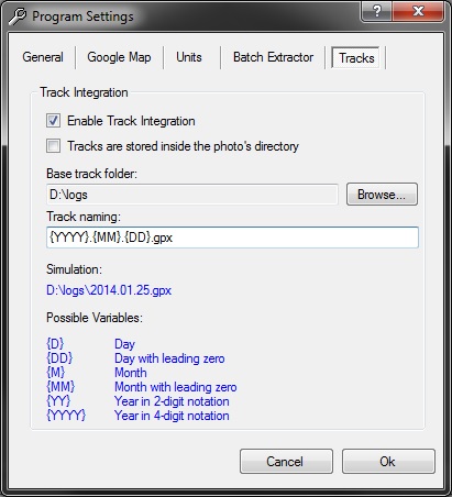
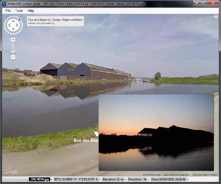
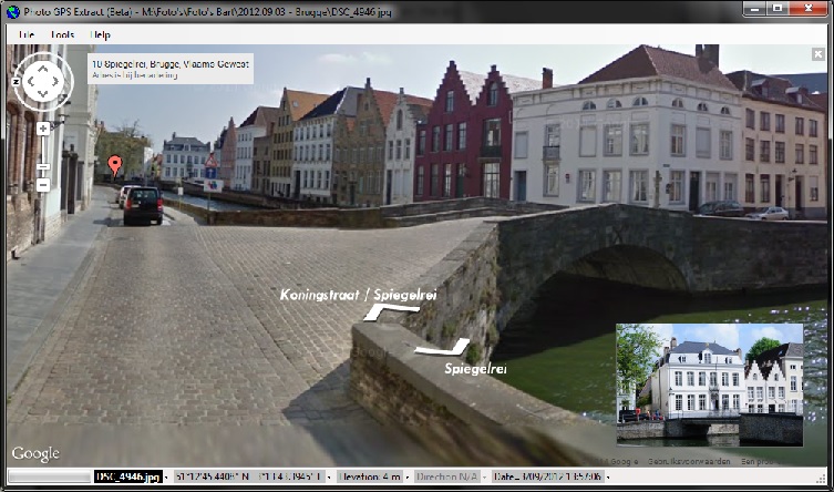
Photo GPS Extract 5.0 has a new option that allows you to open the images in streetview mode, instead of showing the location on the map. Photo GPS Extract will try to read the heading information from your picture (if your camera is equipped with a digital compass) so the direction of the picture correponds with the viewport in streetview.
You can even see the (close) surrounding photo locations while in streetview mode. You then can jump between locations just by clicking one of the visible markers:
Copyright ©1998-2022 Vanderhaegen Bart - last modified: March 26, 2014
